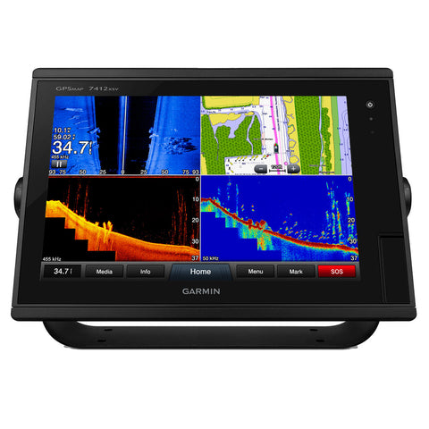
Garmin GPSMAP7412XSV 12-inch Multi-touch Widescreen Chartplotter/Sonar Combo
Garmin GPSMAP7412XSV 12-inch Multi-touch Widescreen Chartplotter/Sonar Combo
Worldwide basemap
Model: 010-01307-02UPC: 753759132446
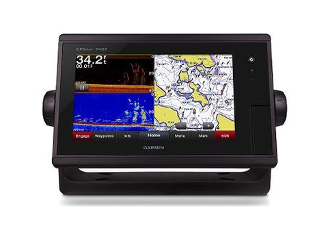
- 12-inch multi-touch widescreen display (1280 x 800 WXGA)
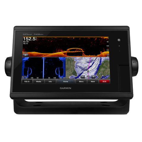
- Built-in dual CHIRP sonar plus CHIRP DownVü and CHIRP SideVü scanning sonar with the clearest images on the water (transducer sold separately)
- High-sensitivity internal 10 Hz GPS/GLONASS
- Fully network capable for Garmin Marine Network and NMEA 2000®, plus NMEA 0183 support
- Supports GSD™ 26 professional sonar module
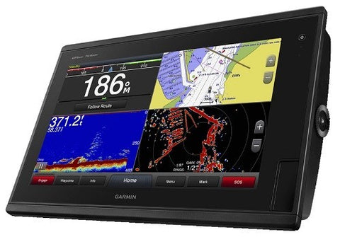
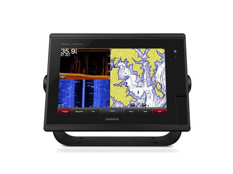
Designed for sportfishermen, cruisers, sailors and sailing racers who demand high performance, ease of operation and feature integration in a chartplotter/sonar combo. The 12-inch multi-touch widescreen GPSMAP 7412xsv combo includes built-in dual CHIRP sonar plus CHIRP DownVü and CHIRP SideVü scanning sonar with the clearest images on the water. Its internal 10 Hz GPS updates your position and heading 10 times per second. GPSMAP 7412xsv is fully network capable, including Garmin Network and NMEA 2000, and offers the conveniences of built-in Wi-Fi® connectivity.
Built-in Advanced Sonar CapabilitiesThe built-in sonar capabilities of the GPSMAP 7412xsv include 1 kW dual CHIRP sonar, the most sophisticated sonar technology available for the fishing and boating public. Dual CHIRP sonar provides amazingly clear target separation and definition because it puts even more energy onto the target than CHIRP. It gives you the ability to show low/high, med/high or low/med on the screen at the same time, enhancing your ability to distinguish between game fish and balls of bait fish. It also includes both CHIRP DownVü and CHIRP SideVü scanning sonar that provide nearly photographic sonar images of fish and structure that passes below and to the sides of your boat. Garmin DownVü and SideVü provide the clearest scanning sonar images on the water. Also supported are 50 kHz/200 kHz, 77 kHz/200 kHz and Minn Kota® and MotorGuide® trolling motor transducers (sold separately). GPSMAP also includes sonar-recording capability that coordinates the timing of the sonar return with your boat's position and saves digital information for playback on a computer using HomePort™ planning
software.
Full-network compatibility allows you to add more capabilities to your boat. GPSMAP 7412xsv supports radar, autopilot, instruments, multiple screens, FUSION-Link, sensors, remote sonar modules, digital switching, thermal cameras, GRID rotary knob, joystick and keypad control, and more.
Add Array or Dome RadarYou can add your choice of Garmin marine radar, including our powerful xHD2 open array radars or xHD dome radars that pairs ease of use with advanced open array features.
Network SharingGPSMAP 7412xsv allows you to share features with other compatible GPSMAP units, such as sonar, radar, supplemental maps and user data, including waypoints, routes and tracks. User data entered into 1 chartplotter can be automatically synced with other chartplotters in a network.
Heading and Position Refreshed 10 Times Per SecondFast, responsive 10 Hz GPS/GLONASS refreshes your position and heading 10 times each second to make your movement on the screen more fluid. It makes dropping up to 5,000 accurate waypoints — and finding your way back to them —
quick and easy.
Two SD™ card slots provide expandable memory for accessory map purchases, such as LakeVü HD, LakeVü HD Ultra or BlueChart® g2 or BlueChart g2 Vision.
FUSION-Link Entertainment SystemEnjoy the ability to control all compatible FUSION-Link-enabled audio systems directly from your compatible chartplotter display.
Built-in Wi-Fi/ANT+™Built-in Wi-Fi/ANT for use with Garmin Helm™ and BlueChart Mobile.
Special Sailing FeaturesSupported sailing features include laylines, enhanced wind rose, heading and course-over-ground lines, true wind data fields and tide/current/time slider. Gauge displays are designed to provide important need-to-know information at a glance, including true and apparent wind angle, set and drift, true or apparent wind speed, horizontal or vertical graphs, and a data bar with customizable data fields.
Compatible with gWind™ TransducersGarmin gWind, gWind Wireless and gWind Race transducers feature twin-fin technology with 3-bladed propeller. Connect to the NMEA 2000 and compatible Garmin chartplotters via the GND™ 10 black box bridge.
Black Box InterfaceThe GND 10 black box interface seamlessly integrates Nexus instruments and sensors with the Garmin family. It converts data between the Nexus network and NMEA 2000 to provide trouble-free compatibility between Nexus and Garmin products.
View and Control Your Device from a Smartphone or TabletGarmin Helm allows you to view and control your compatible Garmin chartplotter from a compatible smartphone or tablet while providing enhanced situational awareness for the mariner. Easily switch between portrait and landscape mode to accommodate mounting preferences. When using an iPhone® or iPad®, you can even record a
movie of your chartplotter screen to share with friends and family. Download from The App Store™ or Google Play™.
With BlueChart Mobile, a free app downloaded from the App Store, you can plan marine routes on your iPad or iPhone then wirelessly transfer them to your boat’s compatible networked Garmin chartplotter. Even if you don’t have a Garmin chartplotter, you can still take advantage of the tremendous features of BlueChart on your Apple device.
iPhone and iPad are trademarks of Apple Inc. App Store is a service mark of Apple Inc. Android and Google Play are trademarks of Google Inc. Wi-Fi is a registered trademark of the Wi-Fi Alliance.
Specifications| Physical & Performance | |
| Physical Dimensions | 13" x 8.9" x 3.1" (33.0 x 22.6 x 7.9 cm) |
| Display Dimensions | 10.3" x 6.4"; 12.1" diagonal (26.2 x 16.3 cm; 30.7 cm diagonal) |
| Display Type | WXGA |
| Display resolution | 1280 x 800 |
| Weight | 6.0lbs |
| Water rating | IPX7 |
| Receiver | 10 Hz GPS/GLONASS |
| Antenna | Internal or external over NMEA 2000 |
| Mounting options | Bail, flat or flush |
| Input voltage | 12-32vDC |
| Power consumption | Max power usage at 10 Vdc: 36 W Typical current draw at 12 Vdc: 2.5 A Max current draw at 12 Vdc: 3.0 A |
| Maps & Memory | |
| Preloaded maps | None |
| Accepts data card | 2 SD™ cards |
| Waypoints | 5,000 |
| Routes | 100 |
| Track log | 50,000 points; 50 saved tracks |
| Features & Benefits | |
| Garmin radar compatible | Yes |
| Garmin sonar compatible | Yes |
| NMEA 2000® compatible | Yes |
| NMEA 0183 compatible | Yes |
| Garmin SmartMode compatible (customizable monitor presets) | Yes |
| Supports AIS (tracks target ships position) | Yes |
| Supports DSC (displays position data from DSC-capable VHF radio) | Yes |
| Tide tables | Yes |
| Garmin Meteor Audio System compatible | Yes |
| Supports Fusion-Link compatible marine radios | Yes |
| GSD™ Black Box sonar support | Yes |
| GCV™ Black Box sonar support | Yes |
| BlueChart® Mobile (planning) compatible | Yes |
| Garmin Helm compatible | Yes |
| GRID™ (Garmin Remote Input Device) compatible | Yes |
| Wireless remote compatible | Yes |
| Wireless mouse compatible | No |
| Sonar Features & Specifications | |
| Dual-frequency (50/200 kHz) sonar capable | Yes |
| Dual-beam (77/200 kHz) sonar capable | Yes |
| Frequencies supported | Traditional: 50/200, 77/200, 83/200 Single Channel CHIRP: 40-250 Dual Channel CHIRP: 40-250 SideVü/DownVü: CHIRP 455/800 & CHIRP 260/455 (dependent on transducer) |
| Transmit Power | 1 kW traditional; 1 kW CHIRP |
| CHIRP sonar technology | Yes (Built in) |
| DownVü™ | Yes with CHIRP (built-in |
| SideVü | Yes with CHIRP (built-in) |
| Maximum depth | 5,000 ft at 1kW (depth capacity is dependent on water bottom type and other water conditions) |
| Bottom lock (shows return from the bottom up) | Yes |
| Water temperature log and graph | Yes |
| Sonar recording | Yes |
| Sonar history rewind | Yes |
| Connections | |
| NMEA 0183 input ports | 2 |
| NMEA 0183 output ports | 2 |
| Video input ports | 2 Composite |
| Video output ports | 1 DVI-D |
| Wireless connectivity | Yes |
| Garmin Marine Network™ ports | 2 |
| Additional Features | |
| User interface | Multi-touch touchscreen |
| Auto backlight dimming | Yes |
| Supplemental map sharing | Yes |
| Internal sonar sharing | Yes transmit and receive |
What's in the Box:
- GPSMAP 7412xsv with worldwide basemap
- Power/data cable
- NMEA 2000® drop cable
- T-connector
- Bail mount with knobs
- Flush mount kit
- Protective cover
- Grommet
- Documentation
We Also Recommend