Garmin GPSMAP7616XSV 16" Sonar Plotter
UPC: 753759132569
- 16-inch multi-touch widescreen display (1366x768 WXGA) preloaded with both BlueChart® g2 and LakeVü™ HD coastal maps
- Built-in dual CHIRP sonar plus CHIRP DownVü and CHIRP SideVü scanning sonar with the clearest images on the water (transducer sold separately)
- High-sensitivity internal 10 Hz GPS/GLONASS
- Fully network capable for Garmin Marine Network and NMEA 2000®, plus NMEA 0183 support
- Supports premium GSD™ sonar module
- J1939 connection provides dedicated CAN port for receiving engine data.
Designed for sportsfishermen, cruisers, sailors and sailing racers who demand high performance, ease of operation, and feature integration in a chartplotter/sonar combo. The 16-inch multi-touch widescreen GPSMAP 7616xsv includes built-in dual CHIRP sonar plus CHIRP DownVü and CHIRP SideVü scanning sonar with the clearest images on the water. Also supports 50 kHz/200 kHz, 77 kHz/200 kHz plus Minn Kota® and MotorGuide® trolling motor transducers. Internal 10 Hz GPS updates your position and heading 10 times per second.
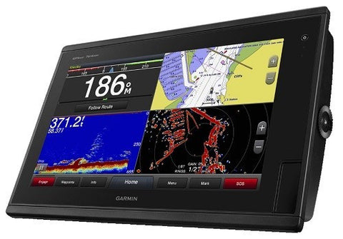
Fully network capable, including Garmin Network and NMEA 2000 (radar, autopilot, instruments, multiple screens, FUSION-Link, sensors, black box sonar, digital switching, thermal cameras, GRID and more), GPSMAP 7616xsv also offers the conveniences of built-in Wi-Fi® connectivity.
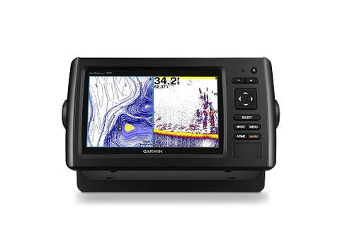
Built-in Advanced Sonar CapabilitiesThe built-in sonar capabilities of the GPSMAP 7616xsv include 1 kW dual CHIRP sonar, the most sophisticated sonar technology available for the fishing and boating public. It also includes both CHIRP DownVü and CHIRP SideVü scanning sonar that provide nearly photographic sonar images of fish and structure that passes below and to the sides of your boat. DownVü and SideVü provide the clearest scanning sonar images on the water. Also supported are 50 kHz/200 kHz, 77 kHz/200 kHz and Minn Kota and MotorGuide trolling motor transducers (transducers sold separately).
Garmin Marine Network and NMEA 2000 SupportFull-network compatibility allows you to add more to your boat. GPSMAP 7616xsv supports radar, autopilot, instruments, multiple screens, FUSION-Link, sensors, remote sonar modules, digital switching, thermal cameras, GRID™ and more.
Add Array or Dome RadarYou can add your choice of Garmin marine radar, including our powerful xHD2 open array radars or xHD dome radars that pair ease of use with advanced open array features.
Network SharingGPSMAP 7616xsv allows you to share features with other compatible GPSMAP units, such as radar, supplemental maps and user data, including waypoints, routes and tracks. User data entered into 1 chartplotter can be automatically synced with other chartplotters in a network.
Heading, Position Refreshed 10 Times per SecondFast, responsive 10 Hz GPS/GLONASS refreshes your position and heading 10 times each second to make your movement on the screen more fluid. It makes dropping up to 5,000 accurate waypoints and finding your way back them quick and easy.
Special Sailing FeaturesSupported sailing features include laylines, enhanced wind rose, heading and course-over-ground lines, true wind data fields and tide/current/time slider. Racing features include pre-race guidance, synchronized race timer, virtual starting line, time to burn and lay line data fields. Gauge displays are designed to provide important need-to-know information at a glance, including true and apparent wind angle, set and drift, true or apparent wind speed, horizontal or vertical graphs, and a data bar with customizable data fields.
Preloaded BlueChart g2 MapsIn addition to the basic charts, tidal stations, currents, depth contours, IALA symbols and included fishing charts, BlueChart g2 offers smooth transitioning between zoom levels and more seamless continuity across chart boundaries. You can customize your screens with Safety Shading which allows you to contour shade for all depth contours shallower than what you determine is your safe depth. Fishing charts emphasize bathymetric contours with less visual clutter on the display. And there’s also a choice of standard 2-D direct overhead or 3-D ?over-the-bow? map views for easier chart reading and orientation.
Preloaded LakeVü HD MapsThese highly detailed freshwater maps include 17,000+ U.S. lakes, rivers and reservoirs. Included in those are more than 5,700 HD lakes with 1-foot contours shoreline to shoreline; excellent detail of underwater features plus Safety Shading that allows you to designate a minimum depth; interstates, highways, general roads and bridges; designated fishing areas; and points of interest, such as docks, boat ramps, marinas and campgrounds.
Upgrade to our Best Maps on the WaterTwo SD™ card slots provide expandable memory for accessory map purchases such as LakeVü HD Ultra with MaxDef Lakes or BlueChart g2 Vision® that add Garmin patented Auto Guidance and other great features.
GND™ 10 Black Box InterfaceThe GND 10 black box interface seamlessly integrates Nexus instruments and sensors with the Garmin family. It converts data between the Nexus network and NMEA 2000 to provide trouble-free compatibility between Nexus and Garmin products, including gWind™ and gWind Race transducers.
Compatible with gWind TransducersgWind, gWind Wireless and gWind Race transducers feature twin-fin technology with 3-bladed propeller. Connect to the NMEA 2000 and compatible Garmin chartplotters via the GND 10 black box bridge.
FUSION-Link Entertainment SystemEnjoy the ability to control all compatible FUSION-Link-enabled audio systems directly from your compatible chartplotter display.
Built-in Wi-Fi/ANTBuilt-in Wi-Fi/ANT® for use with Garmin Helm™ and BlueChart® Mobile.
View, Control Your Device from a Smartphone or TabletGarmin Helm allows you to view and control your compatible chartplotter from a compatible smartphone or tablet while providing enhanced situational awareness for the mariner. Easily switch between portrait and landscape mode to accommodate mounting preferences. When using an iPhone® or iPad®, you can even record a movie of your chartplotter screen to share with friends and family.
Get Onboard with BlueChart MobileWith BlueChart Mobile 2.0, a free app downloaded from the App Store™, you can get reliable weather information while you plan marine routes on your iPad or iPhone then wirelessly transfer them to your boat’s compatible networked Garmin chartplotter. Continue acquire current weather information from your cellular-based Apple® device and stream that data onto your chartplotter screen. Even if you don’t have a Garmin chartplotter, you can still take advantage of the tremendous features of BlueChart Mobile on your compatible Apple device.
Panoptix™ All-Seeing Sonar Down TransducerWith Panoptix Down, you can actually see fish and bait swimming around under your boat — in real time. You can search 3 ways:
- RealVü 3D Historical — find fish while your boat is moving. It shows the entire water column you have passed over in 3-D from the bottom to the surface
- RealVü 3D Down — your boat can be stationary, and you still see things in 3-D below the boat
- LiveVü Down - shows what’s moving around under your boat. See small baitfish and large target fish swimming below your boat.
With Panoptix Forward, you can actually see the bottom, structure and fish swimming around in front of your boat — in real time. You can search 2 ways:
- RealVü 3D Forward - see 3-D views of fish and structure in the water column in front of your boat. You can easily separate the little ones from the big ones you want.
- LiveVü Forward - shows you fish actually swimming toward the boat or moving away from it.
iPhone and iPad are trademarks of Apple Inc., registered in the U.S. and other countries. App Store is a service mark of Apple Inc. Android and Google Play are trademarks of Google Inc. Wi-Fi is a registered trademark of the Wi-Fi Alliance.
Specifications| Physical & Performance | |
| Display Size | 13.6" x 7.6"; 15.6" diagonal |
| Display resolution | 1366 x 768 |
| Waterproof standard | IPX7 |
| Unit dimensions | 16.8" x 10.8" x 3.4" |
| Display Type | WXGA |
| Maps & Navigation | |
| Preloaded maps | BlueChart® g2 (coastal maps) and LakeVü HD (inland maps) |
| Track log | 50,000 points; 50 saved tracks |
| Routes | 100 |
| Waypoints | 5,000 |
| BlueChart® Mobile (planning) compatible | Yes |
| Features | |
| Mounting options | Flat and flush, bail with optional accessory |
| Garmin Marine Network™ ports | 2 |
| Accepts data cards | 2 SD™ cards |
| Maximum depth | 5,000 ft at 1kW (depth capacity is dependent on water bottom type and other water conditions) |
| Antenna | Internal with external connection |
| Wireless connectivity | Yes |
| NMEA 0183 output ports | 2 |
| NMEA 0183 input ports | 2 |
| Receiver | 10 Hz high-sensitivity |
| Video input ports | 2 Composite |
| Video output ports | 1 DVI-D |
| Frequency | Traditional: 50/200, 77/200, 83/200 Single Channel CHIRP: 40-250 Dual Channel CHIRP: 40-250 SideVü/DownVü: CHIRP 455/800 & CHIRP 260/455 (dependent on transducer) |
| Supports Fusion Lync compatible marine radios | Yes |
| DownVü™ | Yes with CHIRP (built-in) |
| Water temperature log and graph | Yes |
| Garmin radar compatible | Yes |
| NMEA 0183 compatible | Yes |
| Bottom lock (shows return from the bottom up) | Yes |
| Garmin Meteor Audio System compatible | Yes |
| XM WX Weather & Radio for U.S. & Canada compatible | Yes |
| Tide tables | Yes |
| Helm | Yes |
| Garmin SmartMode compatible (customizable monitor presets) | No |
| Garmin sonar compatible | Yes |
| Dual-beam sonar capable | Yes |
| GSD™ Black Box sonar support | Yes |
| Supports DSC (displays position data from DSC capable VHF radio) | Yes |
| Wireless remote compatible | Yes |
| NMEA 2000® compatible | Yes |
| Supports AIS (tracks target ships'' position) | Yes |
| Sonar recording | Yes |
| GRID™ (Garmin Remote Input Device) compatible | Yes |
| SideVü™ | Yes |
| GCV™ Black Box sonar support | Yes |
| Sonar history rewind | Yes |
| Dual-frequency sonar capable | Yes |
| CHIRP sonar technology | Yes (Built-In) |
| Wireless mouse compatible | No |
| User Interface | Multi-touch touchscreen |
| Auto backlight dimming | Yes |
| Supplemental map sharing | Yes |
| Internal sonar sharing | Yes, transmit and receive |
| Input Voltage | 10-32 Vdc input |
| Input Draw | Max power usage at 10 Vdc: 57.2 W Typical current draw at 12 Vdc: 3.8 A Max current draw at 12 Vdc: 5.2 A |
What's in the Box:
- GPSMAP 7616xsv preloaded with BlueChart® g2 and LakeVü HD coastal maps
- Power/data cable
- NMEA 2000® drop cable
- T-connector
- Flush mount kit
- Protective cover
- Documentation
We Also Recommend